


Summer hiking in Spain - Where to go from June to August
Hiking in summer means finding a destination where temperatures are mild, especially if you plan to hike for several days in a row. This is why many hikers get up early: leaving early allows you to enjoy the coolness of the morning, avoid the hottest hours (between midday and 2 p.m.), it is better to be in the shade and leave some free time in the afternoon.
And here is the other beautiful side of summer: after a route, there is nothing like a good shower, some rest and going out in the afternoon to discover the town where you are, calmly, without rushing. Perhaps a little terrace, a cold beer, or an open-air dinner with a selection of local products.
If you fancy a plan like this, we have gathered several destinations in Europe where hiking in summer is more relaxed: beautiful scenery, moderate temperatures and charming villages to enjoy along the way.
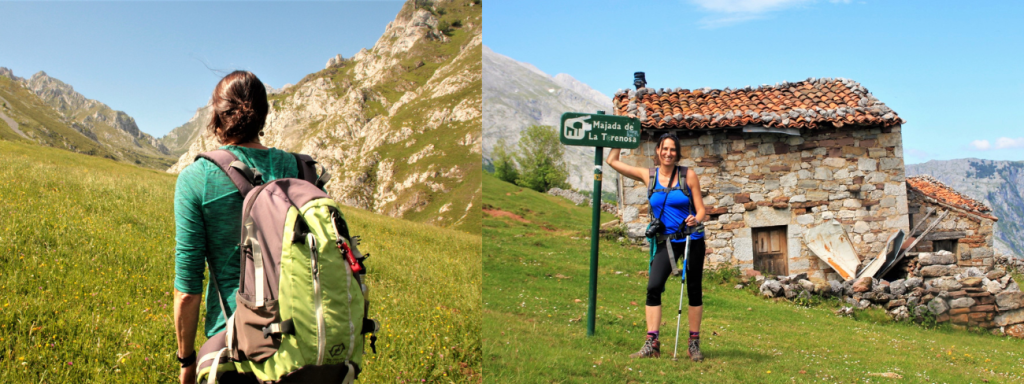
Picos de Europa
A must for any hiker, whether you are an amateur, an expert mountaineer or a beginner looking for something simple. In the Picos de Europa you can find some breathtaking yet demanding routes; not to say that the simpler trails are less spectacular, there is something for everyone no matter the level.
Apart from their geological interest and natural value, the Picos are popular for the views and landscapes they offer, some of which are accessible by car, without even the need to walk.
In this other article you can find several routes in the Picos classified by level of difficulty.
Summer temperatures in Picos de Europa
- Average temperature in July & August: 16 ºC / 60.8 ºF (maximum 20 ºC / 68 ºF)
Recommended route: from Pandébano to the base del Urriellu
Easy-moderate: 12 km / 7.5 miles (one way), 4h, 1070 m ascent
The most iconic route in the Picos de Europa is the Cares gorge trail, followed by the ascent to the idyllic lakes of Covadonga, between green meadows and grazing cows. But as we are looking for something less crowded, we suggest you climb to the base of Picu Urriellu, the peak almost revered by the locals.
This route, which can be done in a morning, is very rewarding because of the views it offers and because it takes you, almost in a straight line, to the middle of the Picos, with arid high mountain landscapes. Technically it is a straightforward route, which can be done with children, and you have the option of having lunch at the Urriellu refuge and coming back down again, or staying the night and having a coffee the next morning over a sea of clouds.
We recommend walking past the refuge until you reach the Urriellu wall. There you will discover some magnificent views.

Ordesa y Monte Perdido
Along with the Vall de Boí and Aigüestortes, the Ordesa y Monte Perdido National Park tops the list of the most beautiful and spectacular places in the Pyrenees.
The landscapes and reliefs of Ordesa leave any hiker who approaches it speechless, with glacial valleys, lakes, forests, waterfalls, meadows and, of course, the immense canyons that cut through it vertically.
Although it is a mountainous area, many routes are adapted to different levels and are well signposted, and in summer the valley is covered in lush green, with waterfalls, and shady spots and a pleasant temperature for walking.
Summer temperatures in Ordesa
- Average temperature in July & August: 18 °C / 65.4 °F (maximum 23 °C / 74 °F)
Recommended route: Cañón de Ordesa - Senda de los Cazadores (Ordesa Canyon - Hunters' Path)
Moderate - demanding: 18 km / 11 miles (circular), 7.5h, 800 m ascent
An absolute classic in the area. You start by climbing the steep zigzag up to the Calcilarruego viewpoint (at 1950 m), and enjoy a descent along the Senda de los Cazadores to the bottom of the glacial valley, with constant views over the canyon.
If you do not like heights or steep slopes, you can follow the river to the Cola de Caballo waterfall and return the same way. On the other hand, the more demanding can add an extra ascent of about 6.5 km (4 miles) / 450 m ascent to reach the Goriz refuge crossing alpine meadows.
This is a comprehensive route, offering shade along much of the route and a wide variety of landscapes. It is ideal to leave early, return mid-afternoon and spend the rest of the day in Torla or the surrounding area.

Euskadi / País Vasco
The compact size of the Basque Country offers a wide variety of landscapes, and in a relatively short time you can go from the sea to the mountains, or from a bustling city to the silence of a beech forest.
Cycling is a popular pastime and the territory is well prepared for cycling routes, but hiking is also very well looked after, with well-marked routes for all levels, such as the GR-38, the GR-121 or the Camino del Norte.
Euskadi is a year-round destination. You can visit Bilbao or San Sebastián / Donostia in the colder months and stroll around the old quarters tasting pintxos and enjoying the great cultural offer. And in the summer, you can take a trip along the coast, cool off on a beach and relax in the evening on the terrace of a village square.
Summer temperatures in the Basque Country
- Average temperature in July: 20 °C / 68 °F (maximum 24 °C / 75.2 °F)
- Average temperature in August: 21 °C / 21 °F (maximum 25 °C / 77 °F)
Recommended route: the first stages of the Camino del Norte
Moderate / about 6 hours a day / stages of between 13 and 26 km (8 - 16 miles), with a considerable accumulated gradient.
The first section of the Camino del Norte between Irún and Bilbao is etched in the memory. You need to be in very good physical condition as the terrain forces you to climb and descend several times a day, but it is well worth the effort. In just a few kilometres you can go from a narrow path between trees above the sea, to a leafy forest, then cross green meadows next to the coast dotted with farmhouses, until you come down to a beach. The route also passes through several villages that are well worth a visit, such as Zarautz, Zumaia, Gernika and Markina-Xemein.
An important note: if you dare to do the Camino del Norte, keep in mind that, although it seems that the first stage ends when you cross the river by boat in Pasaia, there is still one last climb up the steps that lead to the Faro de la Plata (Silver Lighthouse).
The public transport connections between Irún, San Sebastián and Bilbao make it very easy to organise this route, even if you only have a few days. And if you are left wanting more, the rest of the Camino does not disappoint.

The Costa da Morte, Galicia
The Costa da Morte, which stretches between Malpica and Finisterre, is one of the wildest coasts of the peninsula. Its name is due to the number of shipwrecks that occurred in the last centuries, due to the steep cliffs and water currents.
But beyond this dramatic name, the area is also defined by the small fishing villages, harbours, fish markets and taverns, where the people are hospitable and very attached to the land and the sea.
Apart from the company of the Atlantic Sea and the cliffs, the landscape combines forests, meadows and scattered villages, where suddenly a dune or a solitary lighthouse appears. One walks leisurely along the Costa da Morte. Even in summer, many areas and beaches are almost deserted.
Summer temperatures on the Costa da Morte
- Average temperature in July: 19 °C / 66 °F (max. 20 °C / 68 °F)
- Average temperature in August: 19 °C / 66 °F (max 21 °C / 69.8 °F)
Recommended route: Camiño dos Faros between Arou and Camariñas
Moderate, 16 km (10 miles), 5.5 hours, 420 m ascent
The Camiño dos Faros route is a private and altruistic initiative of 4 friends who set out to connect all the lighthouses of the Costa da Morte on foot as close to the coast as possible.
The most beautiful stage of the Camiño dos Faros starts from the small port of Arou and crosses several stretches of cliffs until it climbs one of the highest dunes in Europe. From there, the path gets wilder and wilder as it reaches Praia do Trece.
One of the most symbolic points along the way is the Englishmen's Cemetery, a tribute to the sailors who lost their lives in shipwrecks between 1883 and 1893.
The last few kilometres are quieter, following a gravel track and then through a forest until you reach the village of Camariñas, where you can relax and eat fish or seafood.
There is a less exposed variant, through Santa Mariña, ideal in bad weather, strong wind or for those with vertigo, as it moves away from the edge of the cliff, while maintaining spectacular views over the coast.
Marketing, Web & Design
After studying in my hometown of Barcelona and spending several years abroad, I relocated in 2018 to Cabrales, a beautiful rural area in Northern Spain. I invite you to check out some photos of Cabrales to see the incredible views we enjoy from our office!
After a few years in reservations, I now manage the website and marketing for S-Cape Travel, where I handle design tasks, blog writing, and attend specialized travel fairs.


Opening hours: Mon-Fri 9:00am – 6:00pm (CET)
Opening hours: Mon-Fri 9:00am – 6:00pm (CET)